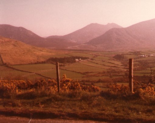
The Mourne Mountains are situated in the south-east of County Down.
They cover 80sq miles of land and are sandwiched between Newcastle
on the coast in the north and Rostrevor on the coast to the South.
The highest mountain here is Slieve Donard at 2796 ft. There
are ten
other mountains who rise to over 2000ft. Only one road crosses the
Mournes, running from Kilkeel on the coast up to the Spelga Dam at
over 1200ft above sea level, then down onto Hilltown. This route,
Newcastle to Rostrevor to Hilltown to Newcastle is about 60 miles
long and provides a circuit of the Kingdom of Mourne as this area is known
as.
There are lots of great walks and climbs in the Mournes and many of its
beautiful sights can only be seen by the energetic. "The Brandy Pad"
for
instance an old smugglers route, "The Trassey Track" used by
quarrymen who once collected the granite and The Hare's Gap to name
only a few.
A tough trail runs up from Newcastle to the peak of Slieve Donard,
for a while it follows the Mourne Wall which was erected in 1904-1922
to enclose the catchment area of the two reservoirs in the silent Valley.
There is a lot of wildlife in the area-hares, or at night
badgers, and birds too- grouse, ravens and Peregrines.
|